

 19.04.2018
Goverla – the highest peak of the Ukrainian Carpathians
19.04.2018
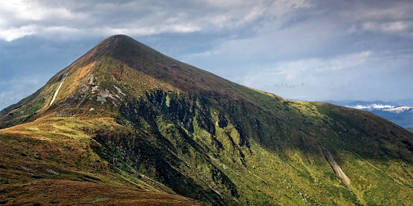
Goverla – the highest peak of the Ukrainian CarpathiansGoverla is known as the highest peak of the Ukrainian Carpathians and the whole Ukraine, is located on the border of Ivano-Frankivsk and region. But there are rumors that it is moving in the direction of Ivano-Frankivsk. It has a conical shape. On the slopes there are rockfalls, large boulders that are “showered” with moss. It is covered with alpine meadows, thickets, juniper, through which it is difficult to break. At the foot of it there is one of the sources of river Prut and a waterfall.
As for wild animals: in the words of people they are rare here, although they say that you can meet even the bear, whom no one has seen yet. There are avalanches. It has stones and conglomerates.
With good visibility from the top of Goverla to the north you can see the valley of Ivano-Frankivsk, Kolomyya and Snyatyn, to the south – Sighetu Marmației. In the northwest – tops Petros and Petrosul.
The name “Goverla” came into use because of an error in the Austrian military map, authentic local name – Hovyrla is completely forgotten nowadays.
In 1996 on Goverla there was built a 5-foot ceiling, which features state symbols – the yellow-blue flag and trident.
Goverla is within the safety zone of Carpathian biosphere reservation and became a major center of tourism. The desire to conquer the highest point in Ukraine, appeared to many people. But the sight of the unity of all Ukrainian lands and cross became not so relevant. Unlike a tradition to leave something in memory of themselves, or to call all friends from the very top. You really don’t want to go down of it, even after the n-th lift.
-
 27.02.2024
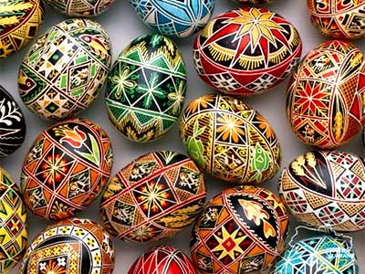
World of pysanka
Embark on a journey into the captivating world of Pysanka, the Ukrainian...
27.02.2024
World of pysanka
Embark on a journey into the captivating world of Pysanka, the Ukrainian...
-
 29.01.2024
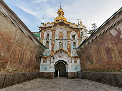
Exploring the Treasures of Kyiv’s Lavra Monastery
In the heart of Kyiv lies the venerable Lavra Monastery, a testament...
29.01.2024
Exploring the Treasures of Kyiv’s Lavra Monastery
In the heart of Kyiv lies the venerable Lavra Monastery, a testament...
-
 13.01.2024
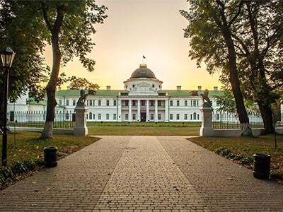
Kachanivka, Eden on Earth
Rich in history, it hosted renowned artists, notably poet Taras Shevchenko.
13.01.2024
Kachanivka, Eden on Earth
Rich in history, it hosted renowned artists, notably poet Taras Shevchenko.